 Street Explor
Street Explor
Street Explor
Advanced AI mapping solutions to uncover crime and crash insights, apply spatial analytics, and seamlessly visualize public safety data for informed decision-making.
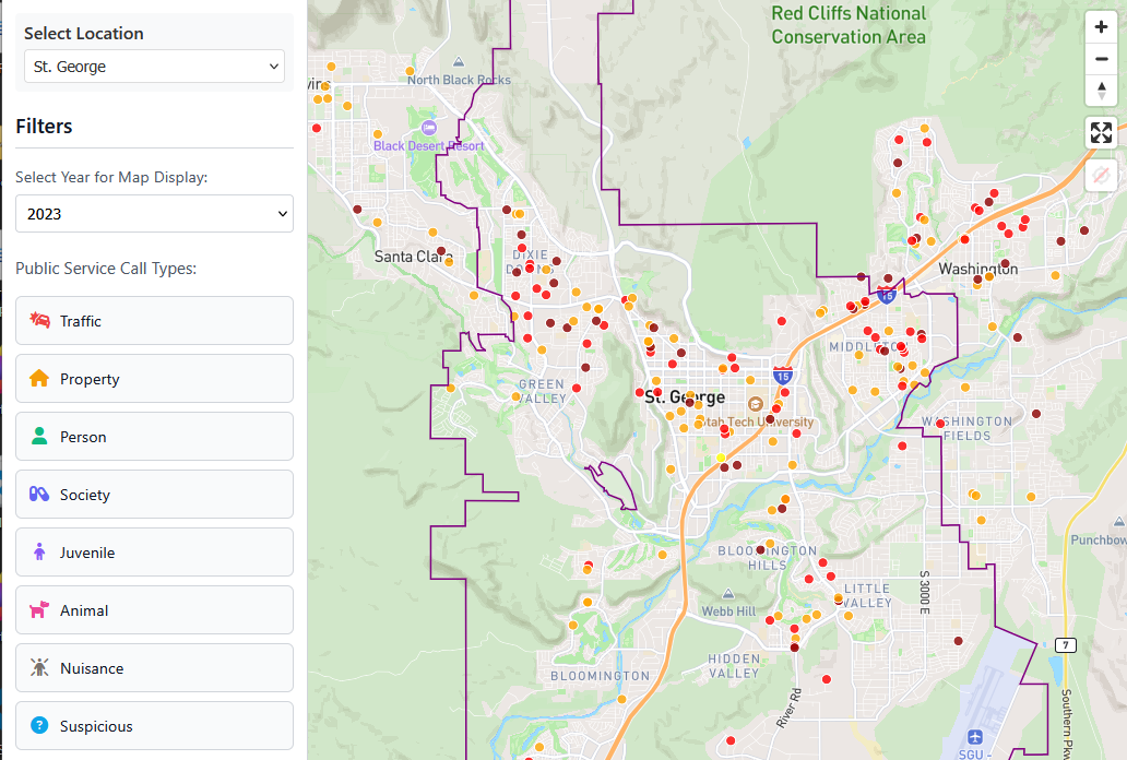
Street-level visualization of crime and crash hot spots with advanced filtering and predictive risk assessment.
Trusted by leading public safety agencies


Leverage a powerful framework that transforms your crime and crash data into location-specific trends, risk patterns, and operational guidance. Combine your data with our advanced analytics to generate comprehensive safety intelligence that supports informed, strategic decision-making.
Use AI and Machine Learning (ML) to turn crime and crash data into predictive insights, enabling smarter decisions and proactive safety planning.
Integrate crime and crash data across jurisdictions to uncover shared patterns and support coordinated, multi-agency responses.
Share public safety data with communities to promote transparency, strengthen trust, and foster collaborative efforts in building safer streets together.
Our advanced AI public safety mapping platform is designed for law enforcement, government agencies, and community stakeholders to easily create interactive crime & crash maps, generate comprehensive reports, and make data-driven safety decisions.
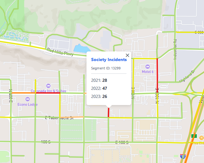
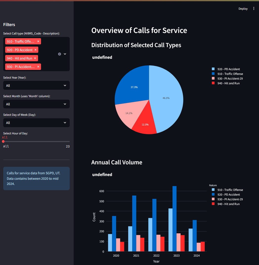
Transform your crime and crash data into powerful visualizations and actionable insights using customizable charts, heatmaps, and interactive spatial maps.
Easily narrow down complex datasets by crime type, location, time period, or custom parameters for precise safety analysis.
Analyze geographic risk patterns with dynamic radius and drive-time visualizations for strategic patrol planning.
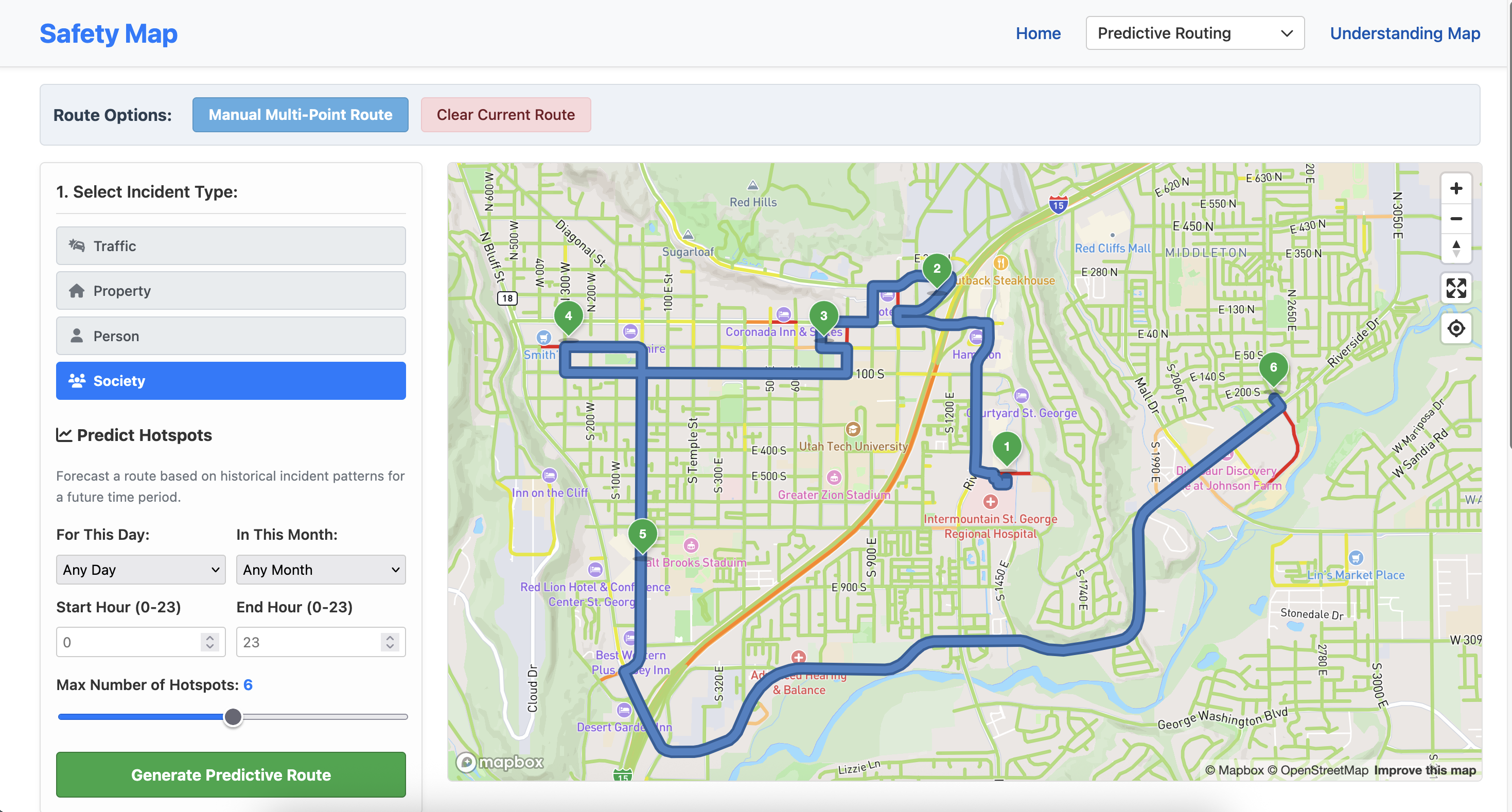
Identify future crime hot spots using advanced analytics to prevent incidents before they happen through proactive policing.
Generate actionable insights and comprehensive risk assessments for law enforcement and urban planners.
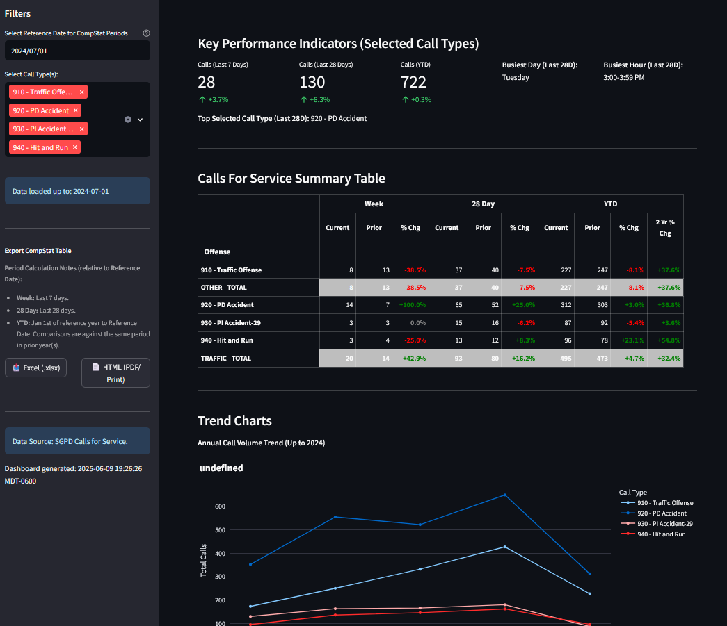
Track and analyze emergency response performance with customizable dashboards and reporting tools.
Import crime reports, crash data, and incident records to integrate seamlessly with built-in safety analytics tools.
Export processed safety data and analysis results in various formats for law enforcement and government compliance.
Collaborate in real time with shared safety projects, enabling multiple agencies to work together on crime and crash data.
Discover how Street Explor can help your agency turn crime and crash data into actionable intelligence. Let's build safer communities together.