
Technology & Data
Access comprehensive public safety data from law enforcement agencies, government sources, and community safety initiatives.
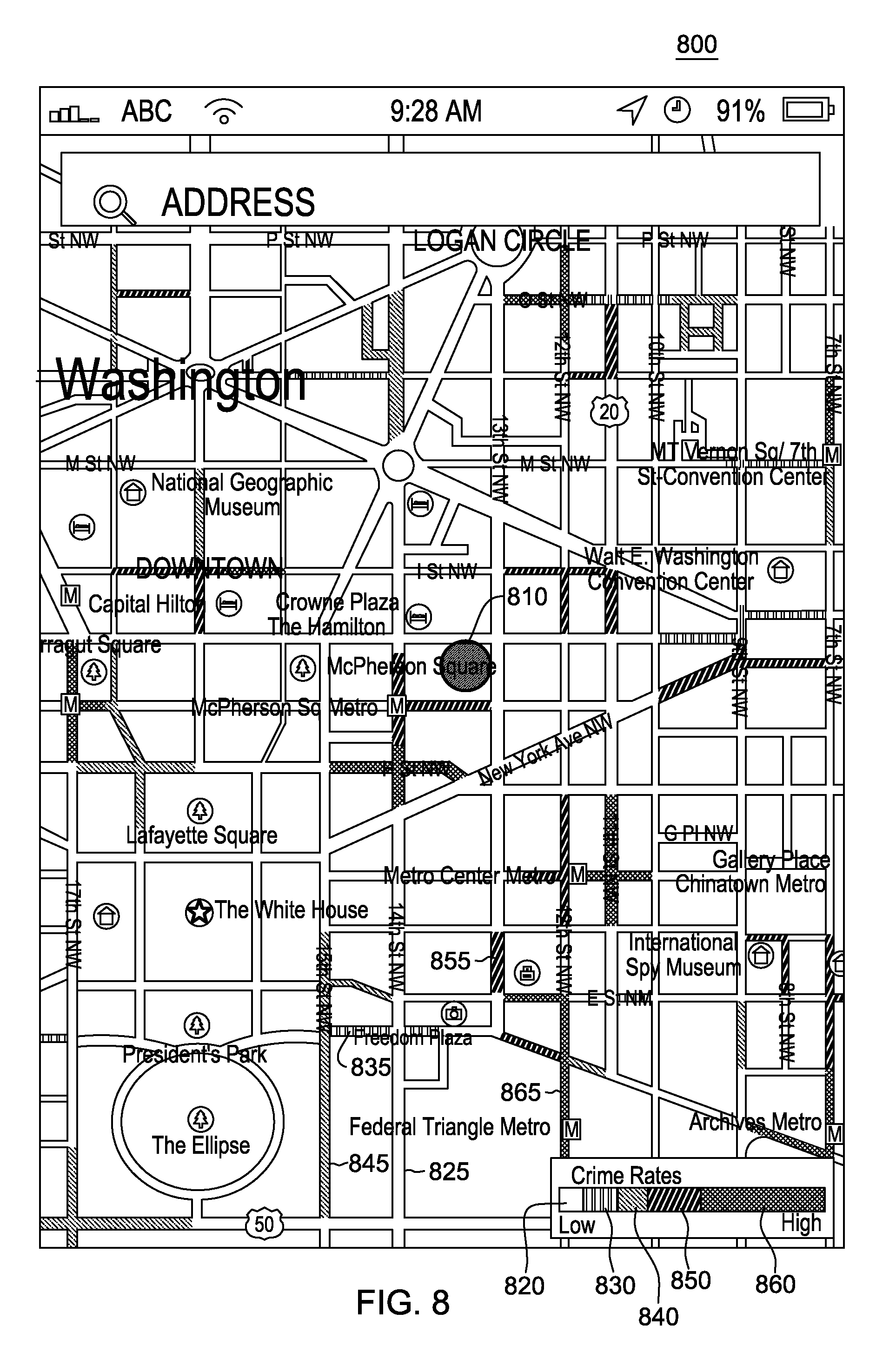
Our Patented Technology
This section features our patented Crime and Crash Hot Spot Mapping technology—an innovative system that visualizes extensive crime and crash data at the street level. It highlights areas of low to high risk, helping users identify potential danger zones with precision.
The technology is designed to protect individual privacy by mapping incidents to street segments rather than specific home or business addresses.
Crime Data
Comprehensive calls for service data from law enforcement agencies
Key Variables
- Call Type & Classification
- Location & Geocoding
- Date & Time Stamps
- Victim & Suspect Demographics
- Case Status & Resolution
- Property Value & Damage
Data Sources
- NIBRS (National Incident-Based Reporting System)
- Local Law Enforcement Records
- State Crime Statistics
- Federal Crime Data
Traffic Data
Traffic incidents, crashes, and safety statistics
Key Variables
- Crash Type & Severity
- Crash Location
- Crash Date & Time
Data Sources
- State DOT Records
- Police Crash Reports
- Traffic Monitoring Systems